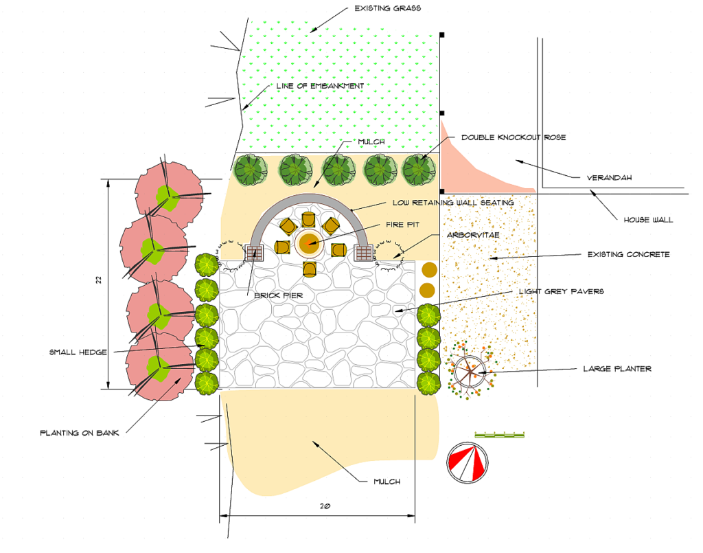
Creating a base site map is the first step a landscape designer needs to take when using CAD software. Here, we show how to use gCADPlus software to create a new landscape drawing of a base site map in gCADPlus from a mud map where the base unit is decimal feet. Once the base map has been created, a designer can position elements such as lawns, garden beds, paths, etc., with the accuracy afforded by CAD software. Symbols can then be added, each symbol assigned to an entry in an accompanying plant database file, and a final plan can be created.

![]() How do you create a new (USA) landscape drawing in gCADPlus from a mud map where the base unit is decimal feet? We stress the importance of drawing full size and not to a scale such that when inquiries of distances are made in the full-size model (modelspace), these return meaningful values. We create a layout space on an architectural sheet in portrait view and show how changes made in the full-size design in the model space view are automatically reflected in the layout.
How do you create a new (USA) landscape drawing in gCADPlus from a mud map where the base unit is decimal feet? We stress the importance of drawing full size and not to a scale such that when inquiries of distances are made in the full-size model (modelspace), these return meaningful values. We create a layout space on an architectural sheet in portrait view and show how changes made in the full-size design in the model space view are automatically reflected in the layout.
This is an important tip. The movie did not mention the need to switch the polar switch on in the status line of the gCADPlus user interface. This is important, and it’s what keeps the line vertical or horizontal.
This link may assist if you need to convert site measurements in feet and inches to decimal feet.